January at Caballo Loco near Three Points, AZ

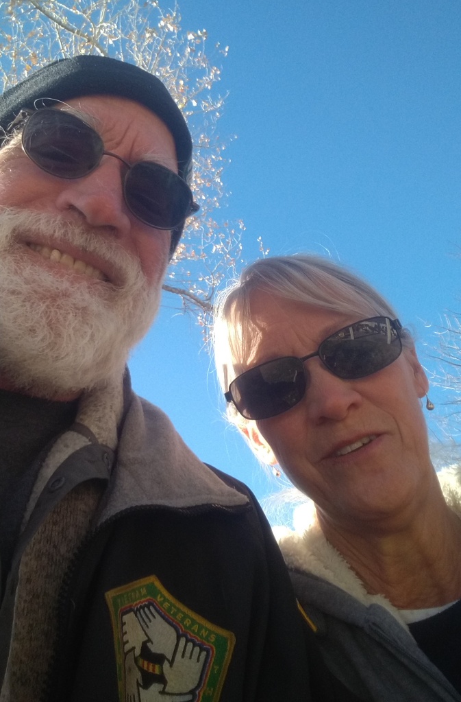
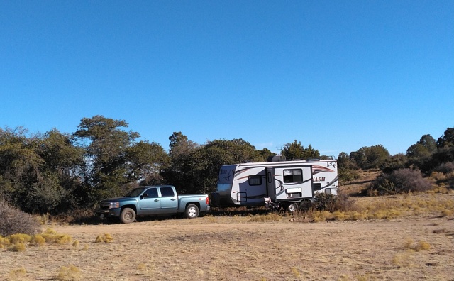
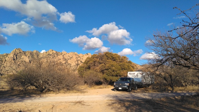
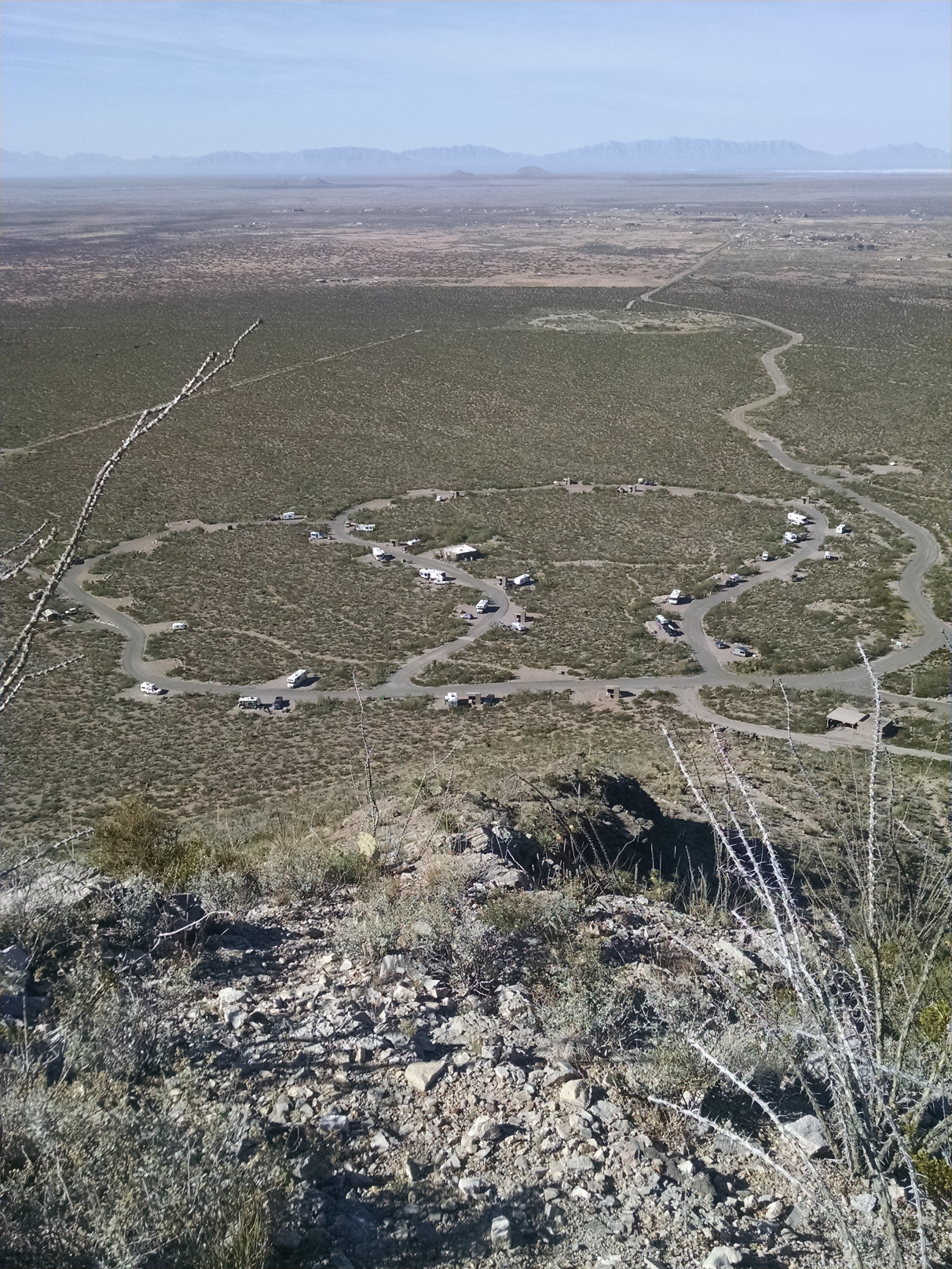
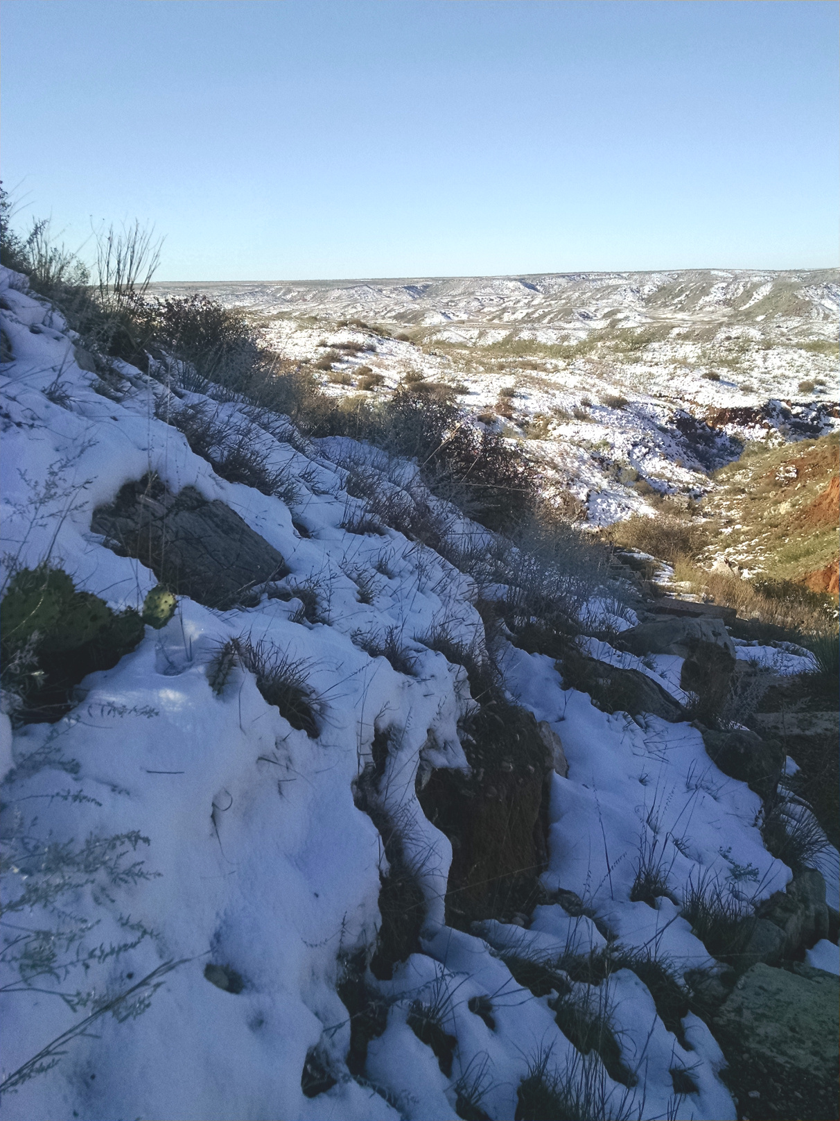
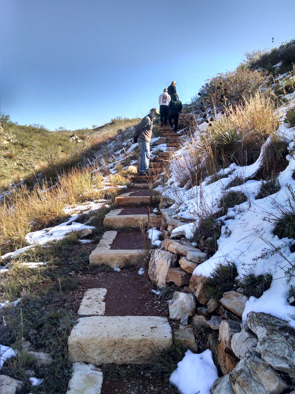
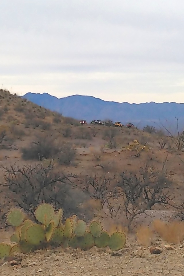
Staying at an RV Resort is a new experience for us – we are generally boondocking types…preferring the “closer to wilderness” experience that National Forests and Bureau of Land Management tracts provide. But we wanted to check this place out, because it seemed…well…different. It is. There is a rustic feel to it and most of the sites have better-than-average space between rigs, but they still have some important amenities such as a laundry and a happy hour. People have corrals with horses here on their plots and almost everyone has one or more ATVs or Side-by-Sides for riding the many trails in the hills. The resort property is also surrounded by abundant BLM land for hiking, and is situated in an historic mining district, which means the geology is interesting. So we stayed here from mid-January to the beginning of February.

Caballo Loco Ranch and RV Resort Near Three Points, AZ
Riding the Off-Road Trails is a Popular Pastime Here

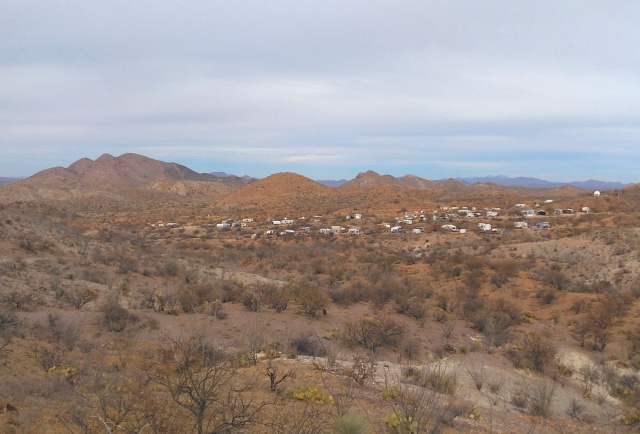
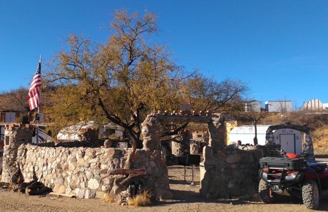
There is a strong community here, some folks have come here for 20 years or more – generally to escape the ravages of winter weather in northern climates in the northern tier of the country. There is a great “do your own thing” kind of vibe, and long term residents have landscaped their plots and added decks, carports and sheds, giving the park the aura of a neighborhood. Some old-timers have created some artful constructions such as the happy hour locus, Fort Kelly…

Fort Kelly -Site of the Daily Happy Hour

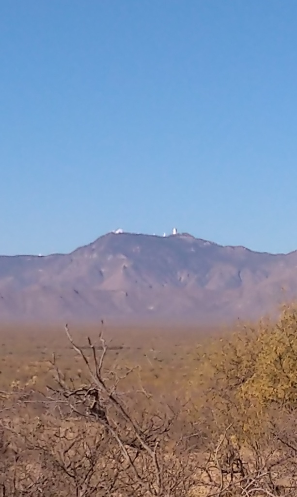
Another enterprising resident built a small, classically styled, rotating shutter dome observatory on the hillside. The observatory itself was recently repaired but is currently lacking the telescope. Speaking of observatories, as we look out from our RV to the mountains west of here the massive structures of Kitt Peak Observatory are visible in the distance.

Kitt Peak Observatory Complex to the West

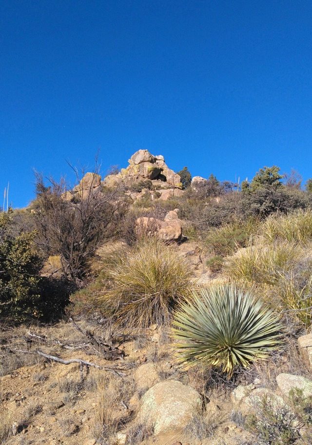
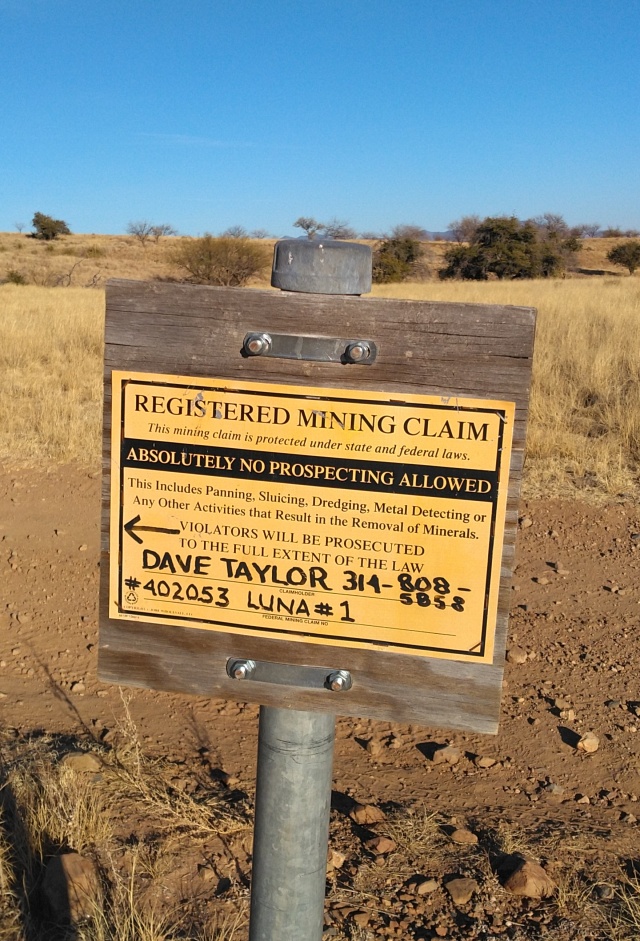
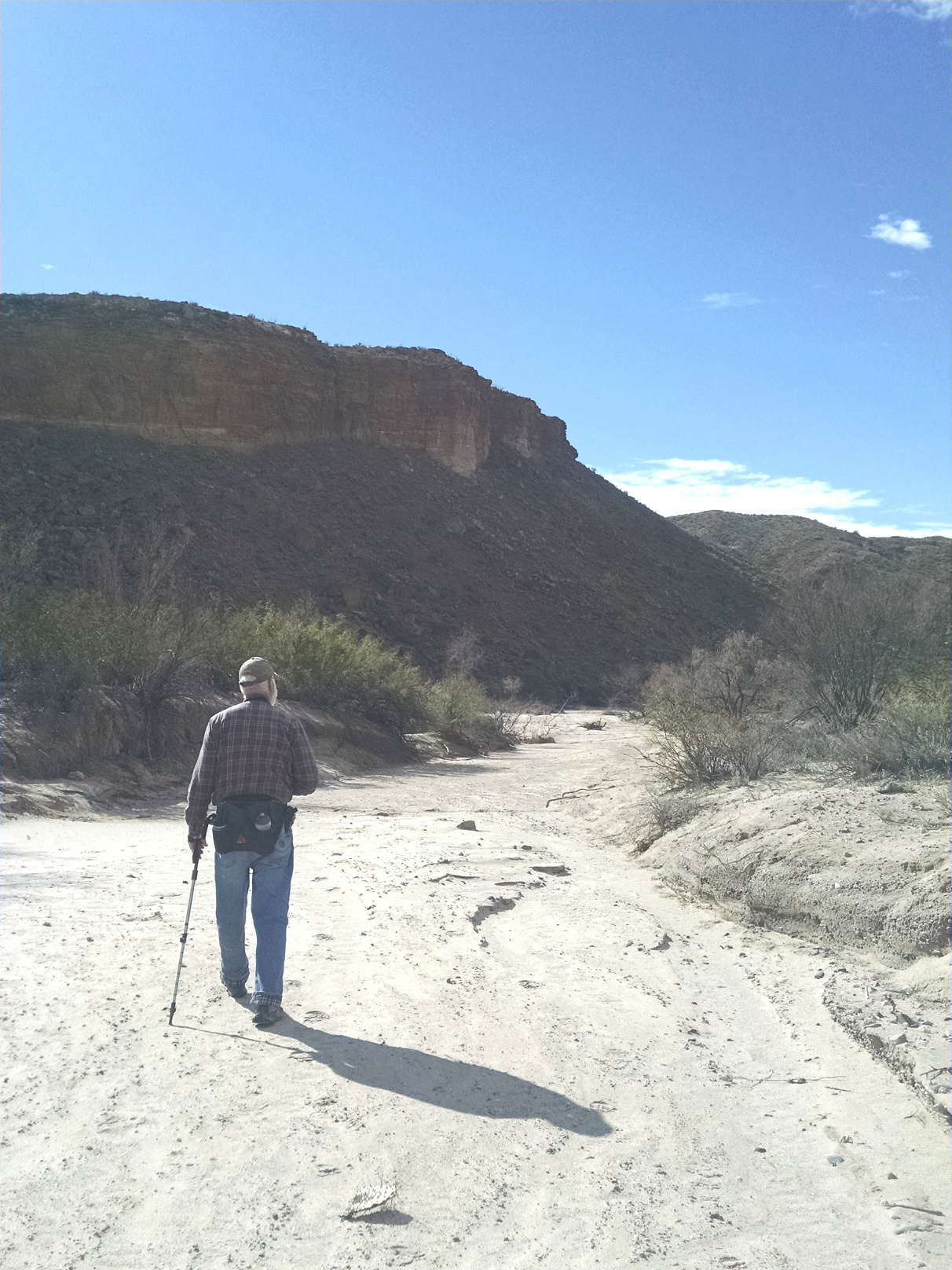
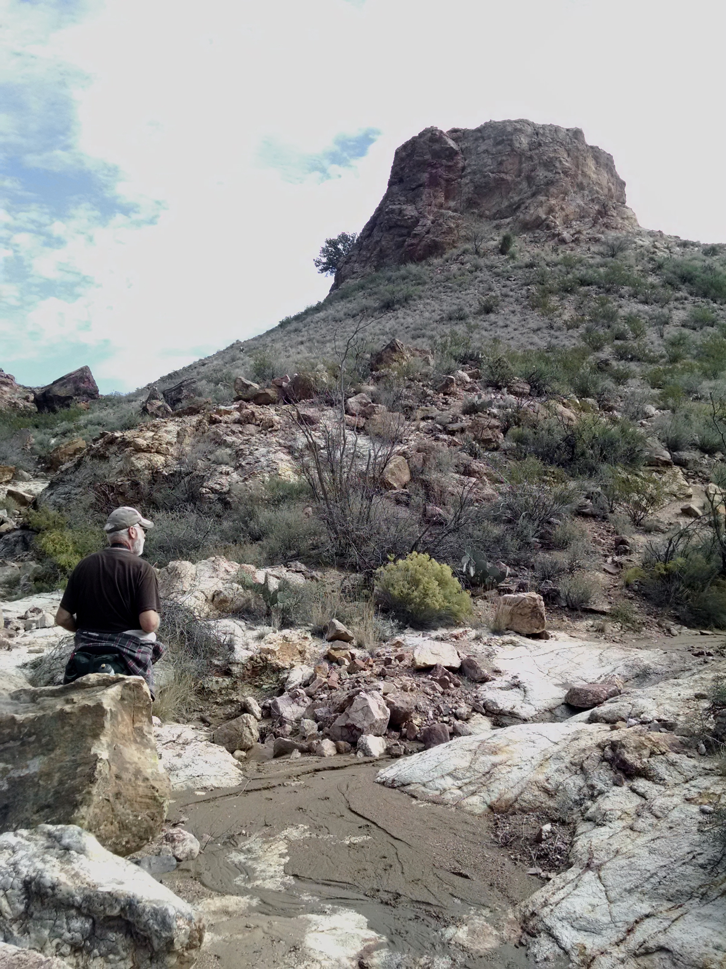
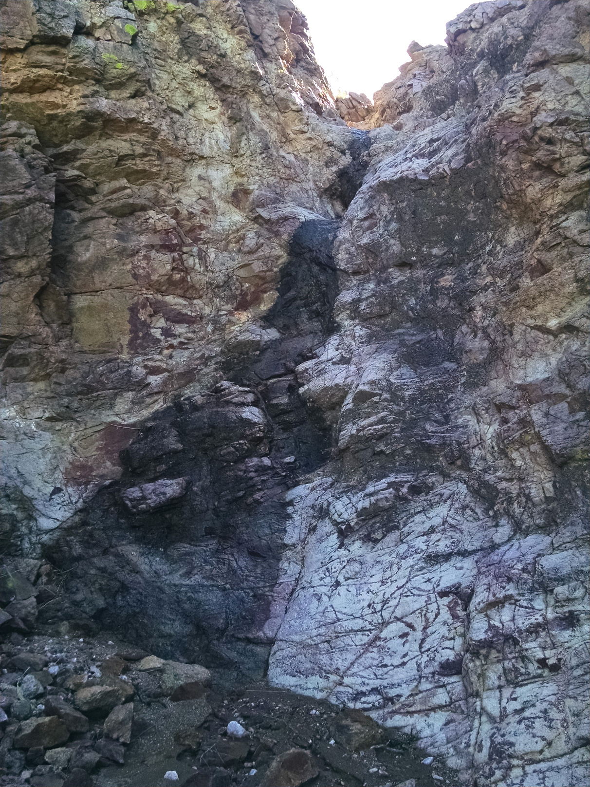
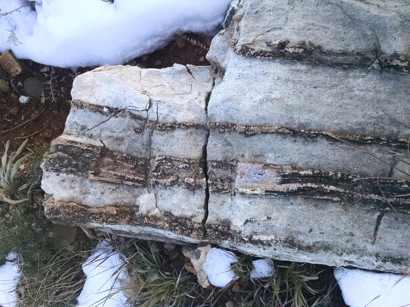
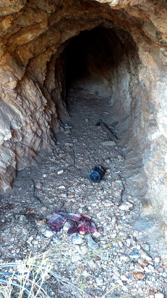
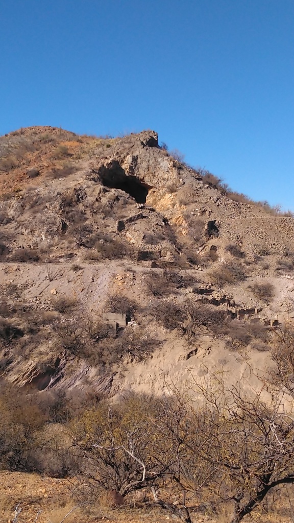
But the thing that really stands out about this place is the mines. Everywhere you go – on every trail we hiked – we could see tailings piles on the hillside. There are shallow pits, deep shafts and mines you can walk into, or drive a truck into. Most are cordoned off with warning signs and barbed wire fences, but some are not. Most are small – but some are massive. Some are used as hideouts for the illegal alien traffickers that have a route right through Caballo Loco.

Ric Inspects a Mine Near Caballo Loco
Mine on the “D” Road
Mine Used as a Hideout for Illegal Aliens

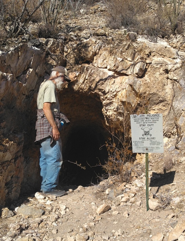
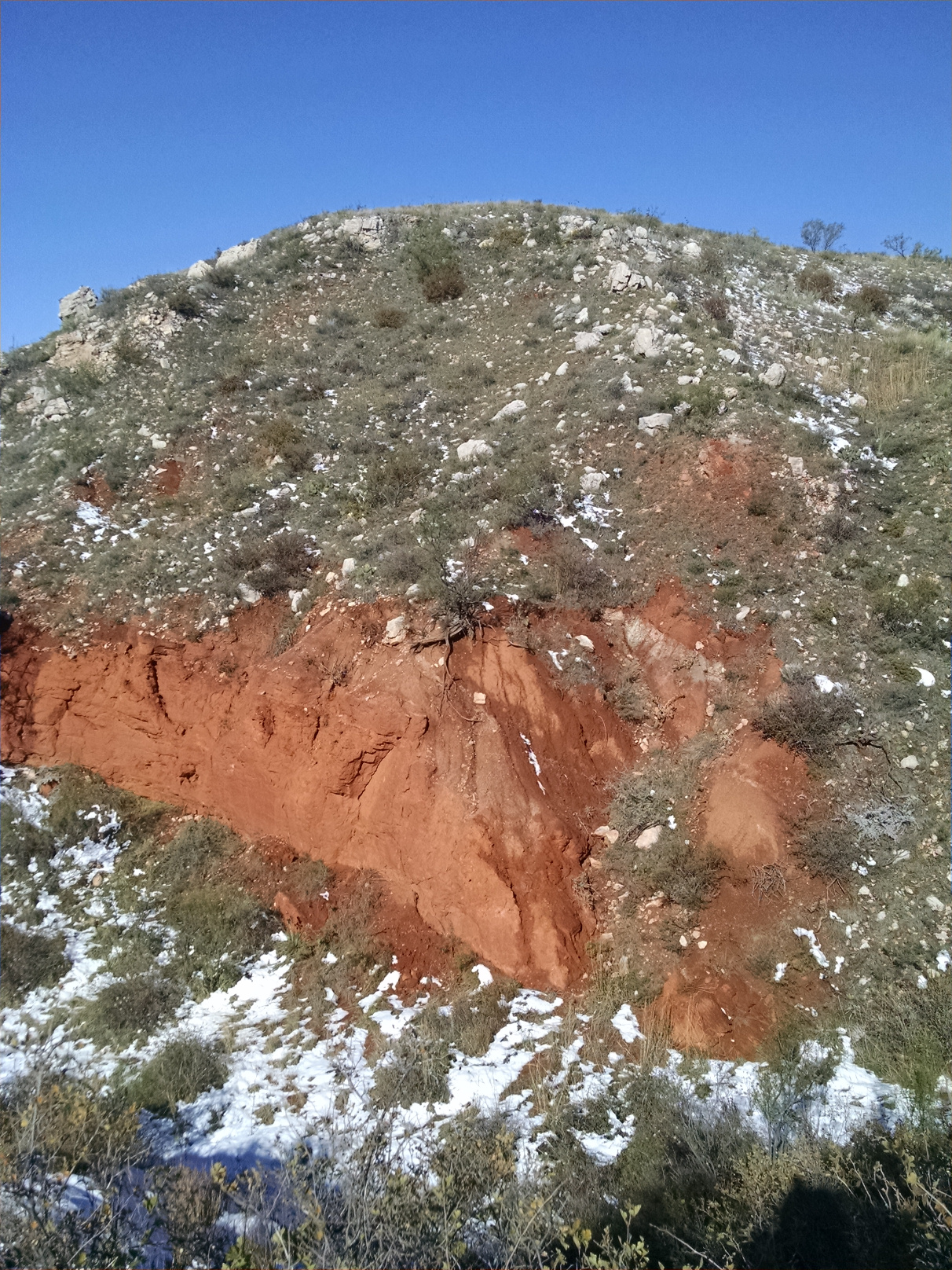
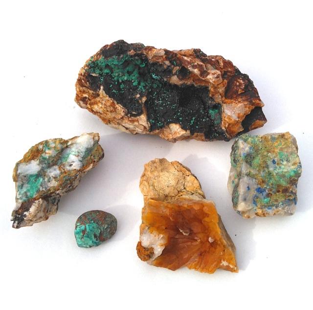
This region is part of the Papago and Sierrita Mining Districts located on the west side of the Sierrita Mountains south of Tucson. The minerals mined here included silver, lead, copper, zinc, iron and some placer gold. The mines have been worked sporadically since the 1870s.

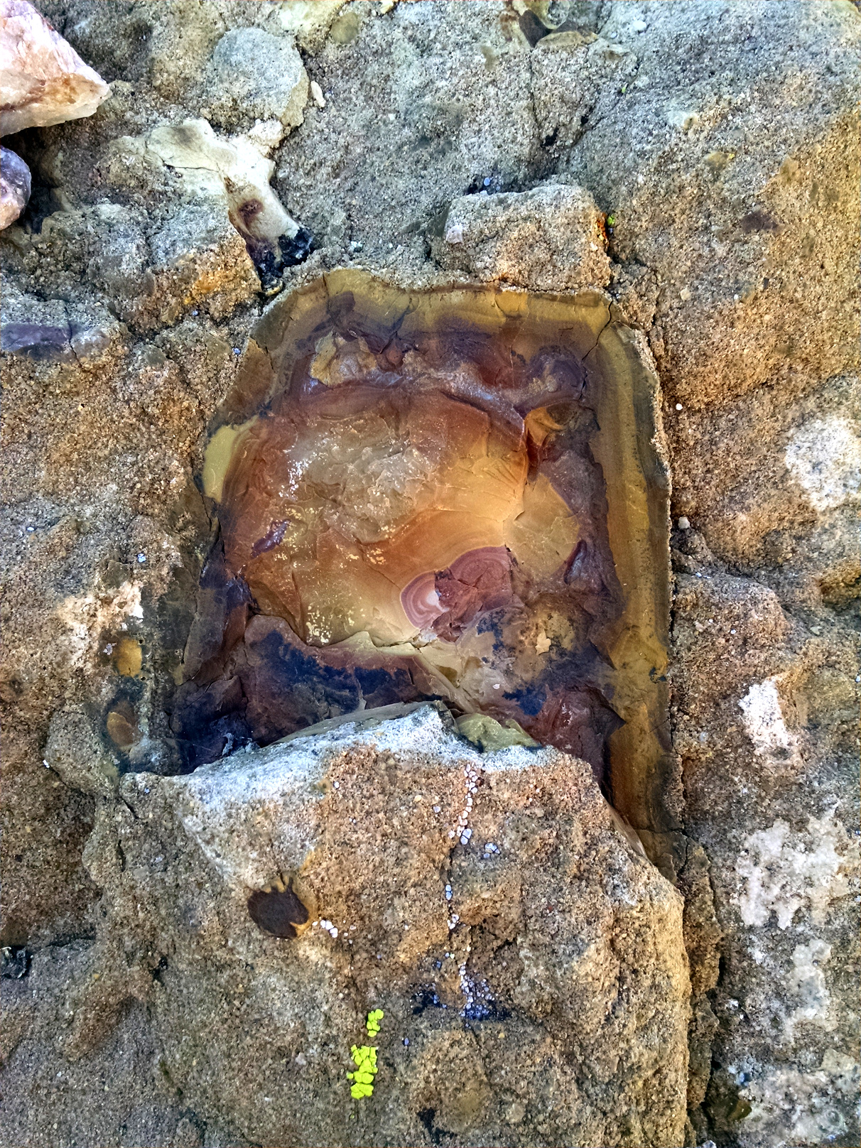
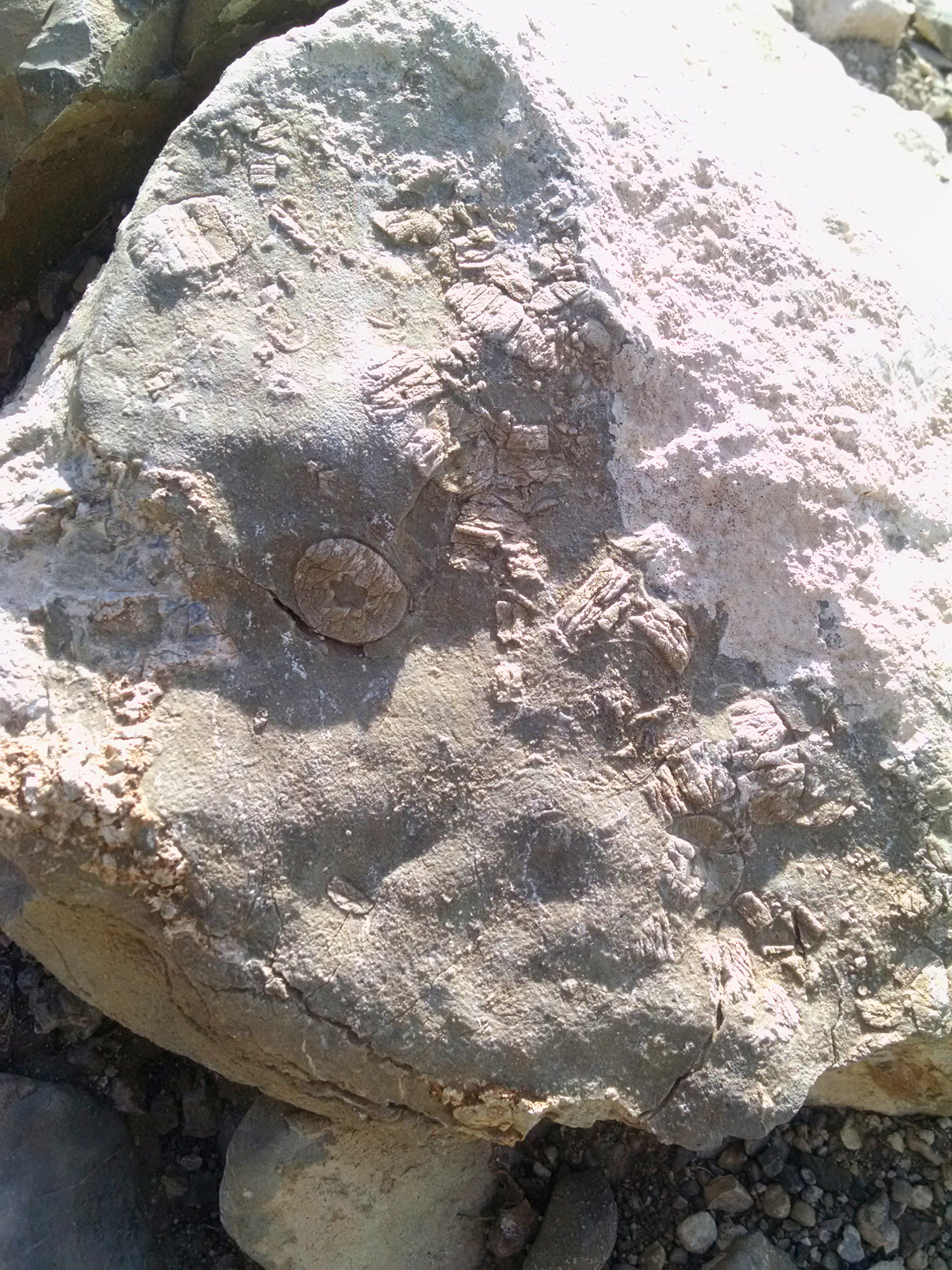
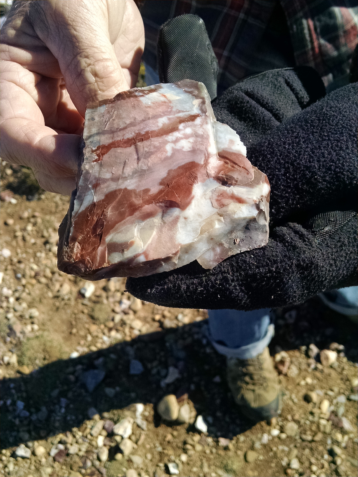
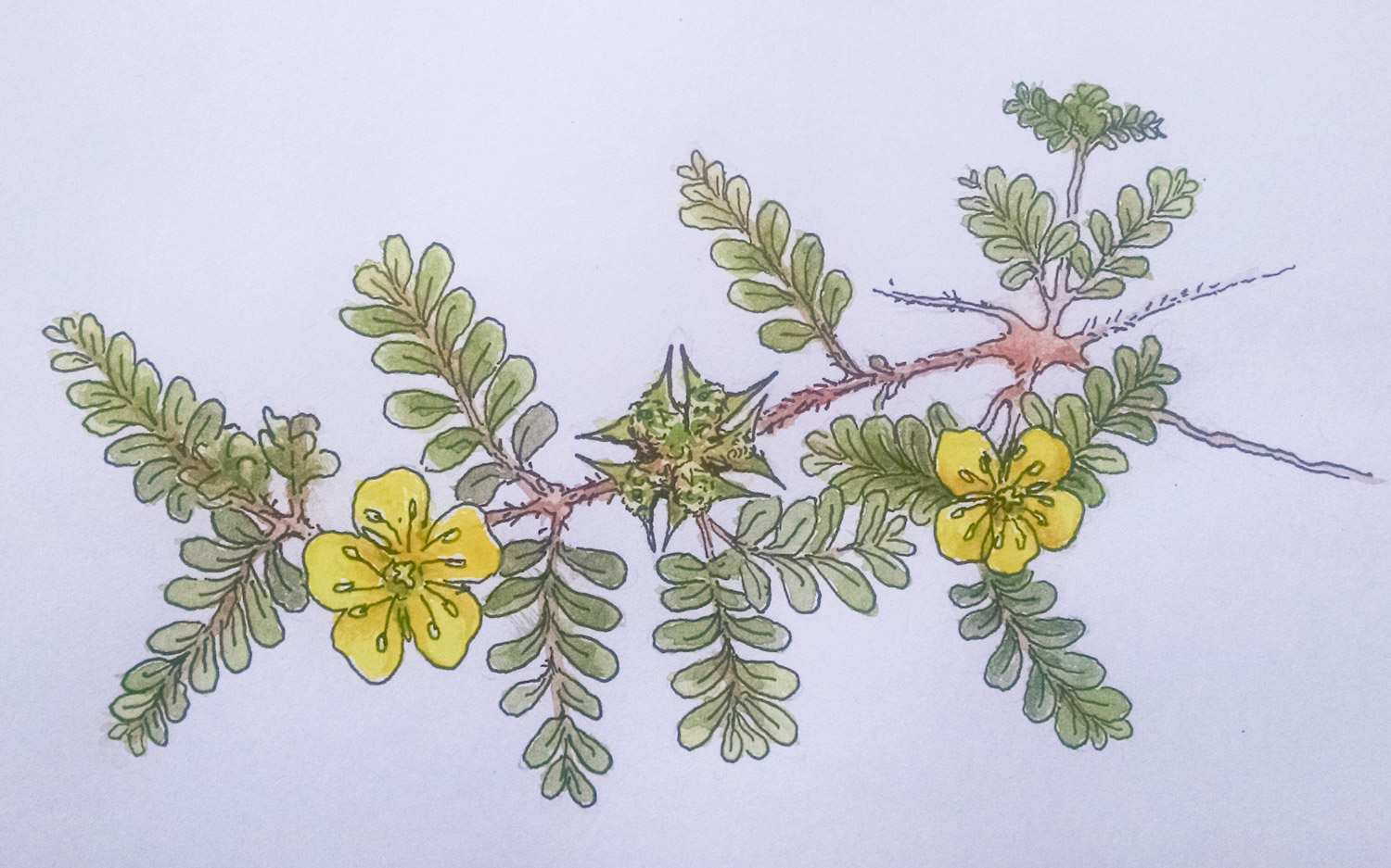
While walking the areas and exploring tailings piles we found a few nice pieces with malachite and azurite, a piece of citrine and one small pebble of turquoise.

A Few of the Minerals Collected at the Papago/Sierrita District

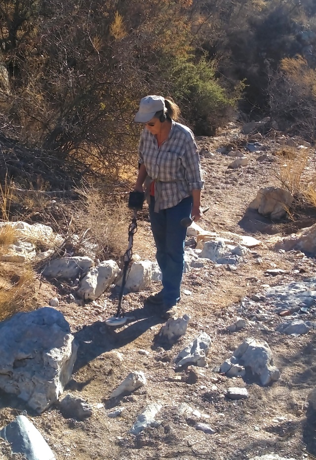
Metal detecting is tricky in such an iron laden and mineralized area…but it’s always good experience to make the attempt in a challenging area.The iron in some of the “hot rocks” was so abundant that it was hard to “unstick” the testing magnet.

Lin Works a Wash with the Metal Detector

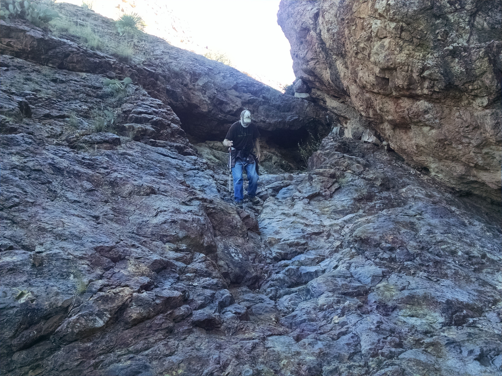
We found our way to the massive “Sunshine mine”, and climbed up to the entrance. We did not go in however, because the entrance was guarded by a large and active beehive. The bees had built the hive into the folds of a curtain stalactite structure high up on the roof near the cave entrance. A few bees were buzzing us as we drew near, so we retreated. We will not mess with bees.

The Massive “Sunshine Mine”near Caballo Loco

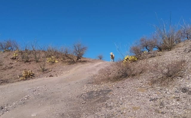
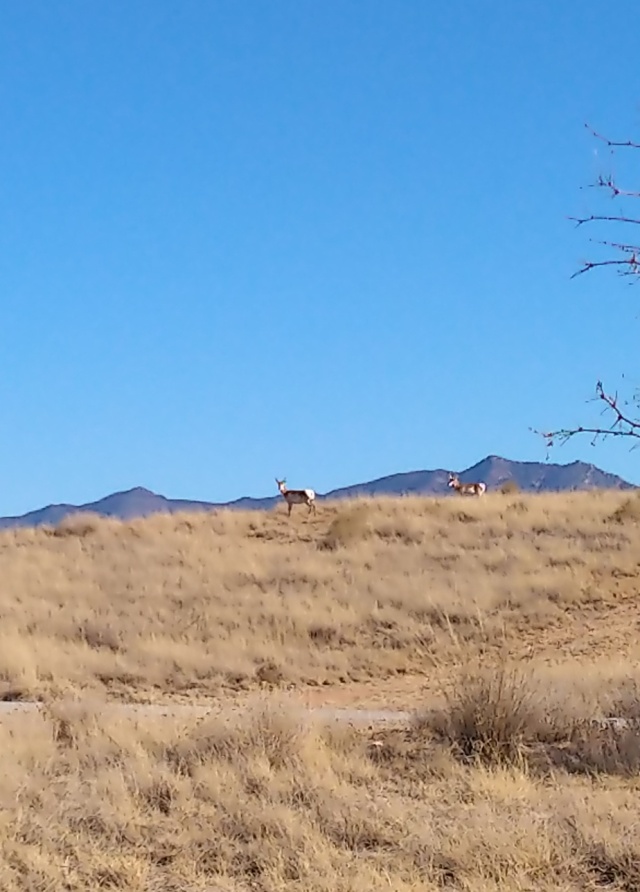
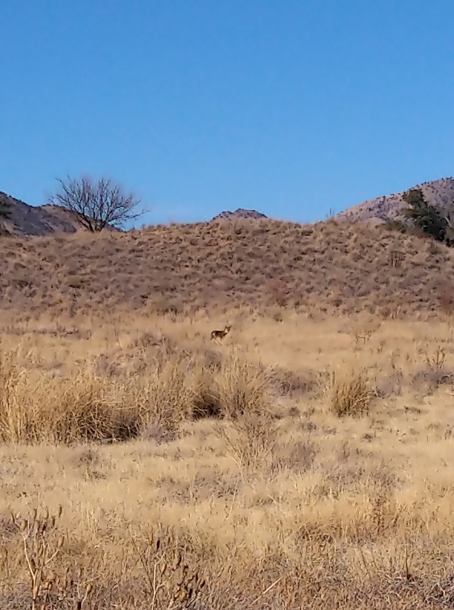
This area is also a very active ranching area, so along with the numerous ATV trails there were many cow paths to walk on, and you never knew when you might encounter a cow or two…

Boviphobia: The Creepy Feeling That No Matter Where You Go, a Cow is Watching You.

Winter Boondocking and Camping through New Mexico and Arizona

During December we pushed onward through New Mexico, spending a few days at Valley of Fire (BLM campground near Carrizozo) and then on to Deming for an overnight at the D.H. Les Combes Winery and Tasting Room (a Harvest Host), where we met up with Ric’s family peeps and pups (who were on their way to their Yuma wintering grounds).

Ric and Sis at Our Meet Up at the Winery in Deming

From there it was just a short hop to one of our New Mexico boondock spots – this one in the Gila National Forest between Lordsburgh and Silver City. We spent spent 11 days there – getting into a groove with hiking. We also accomplished one of our goals this year, which was to get our metal detectors up and running and balanced and practice with them a bit. There are really more shell casings out in the wild than you could ever imagine. Someone has to pick them up.

At Our Gila National Forest Campsite
View from the Continental Divide Trail Near White Signal, NM

By mid-month we forged into AZ where we had originally planned to stay ten days at Cienegas National Grasslands. But after a few days we decided to bail on it for several reasons. First, the southwestern drought has left it particularly crunchy and barren. Second (and most importantly) Vince was uncomfortable with it because he had no trees to climb and little cover. Finally, it was also pretty populated with dispersed campers…and toilet paper treasures left near our campsite. What is it with people anyway? We did our best to clean up what we could while we were there. We always do. The upside of the few days we were there was that we had a good herd of pronghorn hanging around.

Down and Dirty in the Somewhat Barren Landscape at Cienegas
Pronghorn at Cienegas National Grasslands in Arizona

So instead, we tried out a few dispersed camping locations in widely separated portions of the Coronado National Forest. One near Tombstone and the other near Greaterville just north of Sonoita. We are so very glad we did, because we now prefer these locations to Cienegas. Kartchner Caverns State park is midway between them, so we can go spend a few days to “flush and fill” our tanks there when needed. The scenery in both locations is fabulous, and the wildlife is abundant (we saw bobcat, coyotes and a mountain lion while at the Coronado near Greaterville). The hiking is excellent as well – and both areas have trees (hence their national forest designations), which is most agreeable to Vince.

Boondocking near Tombstone and the Dragoon Mountains
Vince Enjoying the Lovely Trees in the Coronado National Forest
A Coyote Hunts for Rodents in the Coronado National Forest

We kept coming upon mining claim signs as we hiked, and with a bit of research learned that this entire region near Kentucky Camp and Greaterville in the Coronado is an historic gold-mining region that still boasts a few “Club Claims” for the Desert Gold Diggers and the GPAA (and others). We renewed our membership in the GPAA this year, so we had some fun working the metal detectors on one of the GPAA claims near us. We also drove and hiked to locate one of their other claims higher up in the Santa Rita Mountains. Next time we come to the southwest we hope to have some better gear for prospecting, which will add yet another “exercise-intensive” activity to our winter recreation.

Whoever this Guy is – He Has a Lot of Claims!

Southwest Travel: November 2020

Prologue: Blog posts for this year are quite delayed due to our being consistently out in the boonies (with limited internet and phone signal) and well, generally lazy. Currently (at Caballo Loco RV Resort in Arizona) our signal still sucks but electricity is consistent so we’ll try to catch up.

Cross Country… An Interesting Time to Travel

So we said “Hey – the northeast isn’t nearly as much of a “Big C” hotspot now. We could use some excitement. Let’s go to Arizona…and let’s bring the cat.”

We’re Going Where?

State park closures were rather hit and miss across the country, and Walmarts were getting hinky too, so we relied a bit more on Harvest Hosts on this particular journey. We left on November 6th and it took us 13 days to travel about 2,300 miles across the country and we stayed at seven Harvest Hosts (mostly wineries), two state parks, one fairground, two city parks and one national recreation area:

> The Farm at Carter Hill (Marlborough, CT)

> Promised Land State Park (Greentown, PA)

> Seven Mountains Wine Cellars (Harvest Host in Spring Mills, PA)

> Webb Winery (Harvest Host in Hermitage, PA)

> Ashland County Fairgrounds (Ashland, PA)

> Wesler Orchards (New Paris, OH)

> Tuscan Hills Winery (Effingham, IL)

> Haven Hollow Farm (Harvest Host in Rolla, MO)

> Bernice Area at Grand Lake State Park (Afton, OK)

> Tidewater Winery (Harvest Host in Drumright, OK)

> Elk City Lake Park (Elk City, OK)

> Lake Meredith NRA (Fritch, TX)

> San Jon Village Park (San Jon, NM)

Wining Our Way Across the Country at Harvest Hosts
Elk City Lake Park in Oklahoma

Note: We did not blow our transmission this time.

We arrived at our first boondock location in the Smokey Bear District in the Lincoln National Forest where we hid out and recuperated from the cross-country trek for eleven days. We were happy to see some snow there because, yeah, that’s why we come south for the winter.

Snowy December Day in the Coronado National Forest

December Travels in New Mexico

We covered some territory in the month of December, gradually making our way across New Mexico. Mostly we were trying to escape the persistent cold weather near Carrizozo, so heading south and west made the most sense. We lingered a bit in the lower Rio Grand Parks and opted out of some of the boondocking that was in our original plan. It’s easier and more economical to enjoy the electric sites available at the state parks instead of burning through tanks of propane in the cold weather!

Percha_RioGrande
Along the Rio Grande near Percha Dam

We stayed at two new (to us) New Mexico state parks along the way… Percha Dam and Caballo Lake, both of which are located along the much dammed Rio Grande River watershed. Percha dam is very popular with the birds, and we saw (and heard) many Sandhill Cranes on the wing as well as Great Blue Herons and other water-loving birds as we walked the trail along the river.

Tonuco Mountain Petroglyphs Hike

One of our favorite hikes in the early part of our journey was the Tonuco Mountain Petroglyphs hike in Ricon. We found it on our “All Trails” app and the trailhead was a reasonable driving distance from Percha Dam. The only real problem was mud holes along the 4-mile-long dirt road going to the trailhead…and swerving into the mesquite branches to avoid the mud gave our truck some “cowboy pin-striping”.
Our poor truck really takes a beating on some of our adventures!

dirty-truck
Mad spattered truck with “cowboy pin-striping”

The hike starts out on a mesa and then drops down into a wash along a cliff. It was clear from tracks that this area is frequented by ATVs, and we saw footprints left by other hikers, but we saw no other hikers on the trail.

TonucoHike
Along the trail on the Tonuco Petroglyphs hike.

Finally, the trail veers left and heads up into a canyon toward the west. Pretty easy going at first, but toward the middle of the trail we had to clamber up some steep rock formations to keep going. We kept our eyes peeled for signs of petroglyphs but saw none on our way up the canyon. There was much interesting geology along the way to keep Linda entertained…including this boulder with lenses of zoned jasper:

Tonuco-Agate
Lens of agate in boulder along the trail.

At a point the trail splits and since it was after noon (and we are slow hikers), we decided to choose one this time and leave the other fork for a future hike. We chose to go to the right. We took a quick lunch break and explored the area a bit. The path ended at a dry waterfall with dark stains left by minerals (likely manganese) in the water.

TonucoHikeFork
The trail forks at this point on the Tonuco hike

TonucoDryFall
The right fork ends at this (currently) dry waterfall.

After exploring we made our way back down the trail and, lo and behold, there were the petroglyphs – facing in a way that only a person hiking DOWN the trail would observe them…

Tonuco-Petroglyphs1
Petroglyph-covered boulder seen on our way down.

Tonuco-Petroglyphs2
More Tonuco petroglyphs…

The entire hike was about 5.5 miles long, and those steep rock faces that we navigated going up the canyon required some careful attention by the two weary hikers coming back down!

Tonuco-Steep
Ric navigates a steep part of the descent.

End of the Month and Westward

The end of the month landed us at Rockhound and City of Rocks State Parks. These were the first New Mexico state parks we ever stayed at, and they remain two of our favorite places for our snowbird travels. On Christmas Day we drove from Rockhound to Oliver Lee State Park, where Ric’s sister and brother-in-law were staying on their way out to Yuma on their own snowbird journey. It was great to spend the holiday with family – and we enjoyed catching up with each other’s winter travel plans!

We celebrated a very quiet New Year at City of Rocks with homemade Margaritas and a Scrabble game (Ric won)… and an attempt to stay up until midnight (we failed).

From there we headed westward into Arizona – but that’s another year and another post…

Happy 2020!!

November Ramblings in the Tularosa Basin

But …before we got to the Tularosa Basin we had an unfortunate event, namely a blown transmission, which held us up in Amarillo for four days. On the bright side, the Love’s Travel Center that we managed to limp into (literally), let us stay there for the duration while we had the truck towed and serviced at S & S Transmission in Amarillo. Son, the Vietnamese owner of S & S, and Ric hit it off and enjoyed some reminiscences about Southeast Asia during the repair process. We’ll just put the expense and inconvenience of that one behind us and hope we don’t have any more truck troubles on this trip. In many ways we were lucky regarding when and where that all went down.

Loves-Amarillo
Waiting out transmission repair at Loves Travel Stop in Amarillo. Thank you Loves!

The rest of the month went pretty much as expected. The only small problem has been some on-and-off cold and wet weather that led us to make some adjustments to our schedule… we were just not confident that the ground wouldn’t get muddy in the planned off-road boondocking site. We also had elevation vs. cold temperature considerations for another site. Those concerns led us to shift to state park stays in the lower Rio Grande Valley (Percha Dam, Caballo and Elephant Butte) to get us through mid-December. We’re still riding out a 3 to 6” snow expected on Thanksgiving Eve here in Carrizozo, but we’ll be on our way southward after the stormy and windy weather clears out on Saturday.

Santa Rosa Lake

We encountered a surprisingly low lake level at Santa Rosa Lake State Park. That did not cause any problems for us – in fact we were able to hike to areas that are normally inundated with water, which was interesting. We had a great site and loved getting out to hike every day after our cross-country trek-where walking/hiking opportunities can be somewhat hit or miss.

LowLake-SantaRosa
Low Lake at Santa Rosa Lake State Park


Lincoln National Forest- Dispersed Camping near Jicarilla

After Santa Rosa Lake we headed southward to camp in the Lincoln National Forest (Smokey Bear District) at a dispersed camping spot. We have camped at this spot numerous times and this time we felt is was time to give something back to the National Forest Service. The campfire ring was in pretty sorry shape…

JP-Fireplace1
Campsite complete with “fixer-upper” fire ring

We spent a morning cleaning out the ash and debris (about ten 5-gallon buckets worth) and distributing it widely to help the plants and prevent an eyesore or mess in one area…

JP-Fireplace2
Ric digging out the ashes and debris.

Then we rebuilt the stone ring and improved the area by policing the area… filling several plastic shopping bags full from the fire ring area and surrounding woods. We found the usual assortment of packaging trash and aging beer cans and other metal debris.

JP-Fireplace3
Cleaned and rebuilt fire ring.

It was a good project and let us work some different muscle groups for the day. It will be interesting to see how full it gets by the next time we visit. This is not a highly trafficked area in the winter months because it is high desert – but it probably gets considerable use in the spring and early fall.

Valley of Fires

From there we went on to Valley of Fires in Carrizozo for a few days. We managed to find a small trail off the primitive camping area that has enhanced our enjoyment of hiking here. We can connect it to the main (paved) interpretive trail to get our daily hikes in the two to three mile range with a bit more nature thrown in…so that’s a plus. After a ten-day stay at Oliver Lee we rebounded back here to avoid having to drive up through San Andres Pass. One blown transmission is enough. Thanks. We’ll take Rte. 380 west to Rte. 25 south and avoid that problem altogether.

VOF-Cactus-on-lava
Cactus growing on lava at Valley of Fires


Oliver Lee State Park

While at Oliver Lee we managed to drag ourselves (once again) up the Dog Canyon Trail hike. We played it conservatively this time, only going as far as the Fairchild Line Cabin at the 2.9 mile mark. That makes for a total out and back hike of six miles, but that’s with a LOT of uphill and downhill so it felt like plenty of hiking for us. That first 6/10th of a mile is always quite the challenge – a rocky, uneven trail with steep gradients that quickly makes a 600-foot gain… and shows a great view of the campground:

OliverLee-overlook
Vista overlooking the campground after that first steep uphill.

The trail levels out for awhile along an extended bench and then gets into a series of up and down ridge hiking. .. again with great views all around – but particularly back down the canyon.

Oliver-DogCan-Midway
About midway through our hike. Looking back down the canyon with White Sands in the far distance.

Just when you’re getting really sick of that up and down stuff the trail levels out again along a second bench in a beautiful meadow dotted with boulders and junipers and cacti.

Oliver-DogCan-2ndBench
Reaching the second “bench” and enjoying a nice easy walk through this flat area.

We always keep our eyes open for fossils along the trail and have never come way disappointed. There are more fossils apparent the higher you go up into the layers of the canyon – as you pass through the beds of ancient seas. Some rocks are absolutely packed with fossil remains…

Oliver-DogCan-Fossils
Observing fossil abundance along the Dog Canyon trail.

A short, steep downhill off the bench brings you to the ruins of the “Line Cabin”. We enjoyed our lunch and took a short break, exploring the area before returning to camp.

Oliver-DogCan-LineCabin
The “Line Cabin” and the terminus of our hike today. Now we just go back the same way we came.

While at Oliver Lee we made a few excursions for other nearby hikes. We did a day trip up to High Rolls, doing a 3 mile hike on the Bridal Veil Falls Trail (T-129). We also visited White Sands National Monument – doing the Backcountry Trail (2.2 miles) plus the Dune Life Nature Trail (1 mile) for another 3-mile plus day of hiking.


But now we’re back in the Carrizozo area and will shortly leave the Tularosa Basin region for parts south and west… and hopefully milder weather!

But first – Happy Thanksgiving!


A Visit to Alibates Flint Quarries

Enroute to our wintering grounds in New Mexico and Arizona we lingered for a few days at Lake Meredith National Recreation Area just north of Amarillo, TX. Having a few days to hike and explore a new (for us) area was a treat. We always enjoy finding new places in our travels. This area will likely be a permanent fixture of our cross-country route. It is a nice distance from our previous overnight at Elk City, OK and a similarly easy distance from Santa Rosa, NM – where we typically book our first New Mexico Parks stay. We also have a choice here to camp for free (at nice, but non-electric sites) or to pony up $24.00 for an electric site. Due to the cold snap, and the fact that we hadn’t had electric for awhile, we opted for electric. Oh – and by-the-way they have a nice big parking area (boat ramp) where you can change a flat tire after you check in.

alibates-map

Part of the Lake Meredith N.R.A. was set aside as a National Monument in 1965: The Alibates Flint Quarries. The stone from this site has been used by humans for at least 13,000 years, and artifacts from many primitive sites throughout western North America reveal that is was highly prized and widely traded. All stone here is considered protected artifacts- so no taking “souvenir rocks” only photos.

Postcard from the Alibates Flint Quarry
Alibates Flint Quarry near Fritch, TX

A visit to the actual quarry sites is by ranger-led tour only, and we spent several hours with our volunteer guide, who was knowledgeable about natural history and the history of the quarries themselves. It was a pleasant day with warming temperatures, but snow still remained on the ground from a snowstorm a few days prior to our arrival.

Alibates Flint Quarry - Snowy Landscape
Snowy Landscape at Alibates Flint Quarry in Texas

After driving a short distance from the visitor center we began a short hike into the small hills. We could look across an arroyo to see the various layers to read the exposed geology of the area, which dates back to the Permian Period, about 290 million years ago.

alibates-geo-layers
Landforms in the Alibates Quarry – Dolomite above Permian Redbeds

Low on the hillside you can see the layers of Permian red beds, river-borne deposits of shale, sandstone and mudstone. Over time, as metallic minerals in these rocks oxidized, they assumed their typical red color.

Above these layers there are whitish rocks and boulders. This is dolomite that was formed in the late Permian (about 260 million years ago). It was formed during one of the many recorded warm periods in Earth’s history, when ocean levels rose and created a shallow sea which stretched from Alaska through the interior of North America, connecting to the Pacific Ocean in Mexico. During this time, as this area was under a shallow sea, dolomite formed from shells, coral, plankton and other organic matter living in this sea. This dolomite boulder shows layers of fossilized algae (the black stripes):

alibates-fossil-algae
Fossilized bands of algae in Dolomite boulder at Alibates Quarry

As we hiked higher up the hill, the terrain became a bit steeper. There we encountered a series of beautifully crafted stairs made from the local rock. We learned that these stairs were constructed as the park was built by “off duty” Navajo firefighters from this area.

alibates-steps
Beautiful steps at Alibates Quarry built by Navajo firemen

At the top of the mesa the beautiful chunks of cast off Alibates Flint became evident underfoot. As we learned, most everything that we saw on the ground was “garbage”material… pieces broken off of finer stones and cast away. The quarries themselves were little more than shallow depressions and without a knowledgeable guide it is quite likely that one would walk right past them without a second glance. The surface material was degraded due to weathering, but apparently they didn’t have to dig very far down to get to good material

 Although the material is called “flint” the good pieces are more agate-like in character. They are translucent and have a waxy luster and conchoidal fracture and most have banding… so either chalcedony or agate – depending on the banding (ILHO: In Linda’s Humble Opinion). We’re sure there is some actual flint there somewhere. This material has a tendency to flake in a very predictable way – which is one of the things that made it such a desirable tool-making material.

alibates-flint-2
Holding a chunk of “Alibates Flint”

After the hike we checked out the museum and watched a flint-knapping video at the Visitor’s Center – and found both to be quite informative.

One final tidbit…Upon reading about the history of the quarry we learned a little history that we found interesting:

In 1906, Charles Gould, a geologist, came to the ranch searching for oil and gas. A local cowboy, Allen “Allie” Bates, showed Gould around the area. Allie Bates was living in an unnamed ravine in a dugout, so Gould named the ravine and nearby features after him, shortening the name to “Alibates.”

(From the website page: https://www.nps.gov/alfl/learn/historyculture/ranching-days.htm)

Back on the Road in 2019

After a year of laying off winter travel… and enduring yet another New England winter… we were pretty happy to get back on the road to the southwestern US.

X-Ctry-Map
Our route across the country.

The Basics:
We left the northeast on October 17th and made our cross-country trek to the southwest, staying at four Harvest Hosts, one State Park (Promised Land in PA), one Walmart (in Clearfield, PA), one rest area (Route 66 Welcome Ctr. In Conway, MO), one city park (in Elk City, OK) and one National Recreation area (Lake Meredith in Fritch, TX). The bulk of our travel was accomplished in ten days – but at day 9 we took an extended 4-day stay at the Lake Meredith Recreation Area in Fritch, TX. Most of our travel days were in the 230 mile range, and for driving entertainment we listened to the remaining books in the Sackett series by Louis L’Amour.

Driving Details:
Our most tense moments were driving through torrential rains in the metro Indianapolis area. Other than that the driving was fairly routine. Wind and snow greeted us in Oklahoma and Texas… that’s a bit of a bummer and hopefully this weather isn’t a harbinger of another cold southwest winter.

Our total gas expenses for the trip (from Massachusetts to New Mexico) were: $684.51

The biggest “Ooops” was forgetting about the Route 44 turnpike tolls in Oklahoma. Ouch. They don’t honor EZ Pass or credit cards and we were low on cash. Had to dig into our laundry quarter cash to make bail and get off their blasted turnpike. We opted out after our Sapulpa, OK stop and took Rte. 75 down to hop onto I-40. Next trip we will make some adjustments to our route to avoid those turnpikes for sure!

Our Harvest Host Stops:

At Maize Valley Winery, one of our Harvest Hosts stops, they were holding their Fall Festival. We went all in, enjoying the pig and duck races, the corn maze and, of course, “Hopnesia” one of their excellent craft brews…

X-Ctry-PigRace
Pig Racing at Maize Valley was one of the highlights of our trip.


X-Ctry-Maze-Corn
“Now where did Linda go?”

X-Ctry-Hopnesia

Our Harvest Host stops included Maize Valley Winery in Hartville, OH; Wesler Orchards in New Paris, OH; Bretz Wildlife Lodge in Carlyle, IL, and the Heart of Route 66 Auto Museum in Sapulpa, OK.

We have to admit that we spend almost as much money at Harvest Hosts as we would at a State Park campsite… but we come away with things we can use like apples and cider, craft beer and a good meal or other entertainment such as corn mazes and pig and duck races. The advantage at the State Parks is that we can take a good nature walk at the end of a long day of sitting in the truck. It’s kind of a toss-up, and its nice to have a mix of the two things as we travel.

Every year we tinker with our overnight stops and although we don’t think we have the perfect trip yet, we’ll keep experimenting and eventually we will. Our biggest problem right now is that we’re running out of Louis L’Amour audio books.

Minerals, Atomic Bombs and UFOs

We have spent considerable time in the Tularosa Basin area of New Mexico this winter… a region steeped in geology, history and mystery.

PSX_20180323_204917

As we sit at Valley of Fires Recreation Area we are wedged between the historic Trinity Atomic Test Site (to the west) and three alleged UFO crash sites (to the east).

PSX_20180323_204901
Our Benchmark Atlas Has Several UFO Crash Sites Demarcated in This Region of New Mexico

For geology buffs this region is a party. There is the lava flow malpais we are currently parked next to at Valley of Fires, and an awesome mineral museum in Socorro at New Mexico Tech.

PSX_20180323_151221
Beautiful Mineral Display at the Mineral Museum at New Mexico Tech in Socorro, New Mexico

On the way back from Socorro we stopped at the rock shop on Rte. 380 and scored small piece of Trinitite, a mineral formed from fused and vitrified sand during the Trinity Atomic Bomb test in 1945.

PSX_20180323_150900
Trinitite Sample from the Trinity Bomb Site. Born on date: 7/16/45

Speaking of Socorro, there was that whole Lonnie Zamora UFO thing that happened in Socorro as well:

https://en.m.wikipedia.org/wiki/Lonnie_Zamora_incident

If you’ve never heard of this 1964 UFO incident, check out the wiki link above. To me, this is one of the most credible UFO (now called “UAP”) sightings ever. The efforts of debunction on this one are simply pathetic.

Perhaps it’s because we just finished listening to Tom DeLonge’s Sekret Machines, but this whole region just feels stranger than fiction.

Part of me thinks that it doesn’t take a “foaming at the mouth” conspiracy theorist to connect some dots in this part of the country.

PSX_20180323_204933
(Credit: CTBTO Photostream)

For example, what if our atomic bomb testing in 1945 caught the attention of someone-something-somewhere with advanced intellect and unimaginable technology. It’s a pretty weird thing to have a nuclear explosion just pop out of nowhere on a heretofore nothing planet for no good reason. Maybe they decided to come check it out. Hence Roswell, Corona and Socorro (to name a few).

Imagine their surprise at what we Earthlings did next:

Now, if I were an extraterrestrial geologist I might be interested in that.


Medicinal (Cursed) Plant: Puncture Vine

This is truly a cursed little plant. You will most likely not see it before you “encounter” it. Then you will step on one of its hard little burrs. Then you will emit an obscenity, or a string of obscenities in response to your pain.

We did just that, and applied the monniker “Little Bastard” to these demonic plant productions until we learned to call them by their most common name “Puncture Vine”.

PSX_20180315_115410
Puncture Vine (Tribulus terrestris) an invasive plant in the Caltrop family.

And puncture it does. Bicyclists have long rued this plant because it can actually puncture their bike tires. Imagine how it feels to your foot.

Its a stealthy little bugger too. It grows low to the ground, prostrate in fact, and does not stand out in the landscape. It can form large mats…all the while steadily producing its weapons.

PSX_20180314_154915
A Sketch of the Burr Nut of the Puncture Vine (Magnified)

The seed pods (burrs) start out green, and turn woody and tan colored by the time they are ready to hitch a ride on your shoe, a tire, your pet’s foot, fur or feathers. They are as hard as as a piece of gravel, and they don’t crumble under pressure. A single plant can produce a million seeds.

Puncture Vine is in the  Caltrop family, and oh what a fitting name that is. A caltrop was a metal device placed on the ground with one spike up and used to slow advancing armies in times of medieval warfare. It is now used by the military to puncture self-healing tires.

220px-Caltrop
A Contemporary Caltrop

The spine arrangement of the Puncture Vine burr nuts are artfully arranged by mother nature so that no matter how the fruit falls, at least one of the spines points up. She was surely in a dark mood that day.

Medicinal Benefits:

In Michael’s Moore’s Medicinal Plants of the Desert and Canyon West, he cites considerable research that supports treatment for elevated blood fats including cholesterols. It may also lessen the severity of arteriosclerosis and atherosclerosis.

This plant has also long been promoted , particularly in Indian and Chinese medicine as a diuretic, tonic and aphrodisiac. Links to two relevant  PubMed articles are included in the resources section at the end of this post.

This plant goes by many names. Here are the ones I have come across: Puncture Vine, Puncturevine, Goat’s Head, Terror of the Earth, Little Caltrop, Bullhead, Burnut, Mexican Sandbur, Tackweed, Devil’s Thorn, Devil’s Weed, and Bindii.

RESOURCES:

USDA Page on Tribulus terrestris: https://plants.usda.gov/core/profile?symbol=trte#

Negative correlation to testosterone increase: https://www.ncbi.nlm.nih.gov/m/pubmed/12804079/

Positive correlation to  androgen increase and nitric oxide release: https://www.ncbi.nlm.nih.gov/m/pubmed/12804079/

Truth or Consequences Veterans Memorial Park & Military Museum

PSX_20180311_132435

This museum and Veteran’s Monument involves an unusual method of honoring and perpetuating the history of our armed services by telling stories from individuals’ viewpoints.

The Memorial is divided into inside and outside displays. The inside focuses on individual memories exhibited on panels, complete with with relics, letters, uniforms, and other displays.PSX_20180311_132517

Outside features a beautifully laid out and manicured memorial complete with a 1/2 scale replica of the Vietnam Memorial that used to be a travelling wall display prior to its purchase by New Mexico.PSX_20180311_132611

There are also granite memorials for every conflict we lost people in. PSX_20180311_132723

I left this memorial with a sense of awe, grateful for the work done by those who created it.